
Thank you for supporting this site ❤️
Make a donation
Make a donation
Pauloff Harbor topographic map
Click on the map to display elevation.
Thank you for supporting this site ❤️
Make a donation
Make a donation
About this map
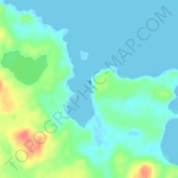
Name: Pauloff Harbor topographic map, elevation, terrain.
Location: Pauloff Harbor, Aleutians East, Alaska, United States (54.45773 -162.69394 54.45783 -162.69384)
Average elevation: 14 m
Minimum elevation: -8 m
Maximum elevation: 58 m
Thank you for supporting this site ❤️
Make a donation
Make a donation
Other topographic maps
Click on a map to view its topography, its elevation and its terrain.