
White Plains topographic map
Interactive map
Click on the map to display elevation.
About this map
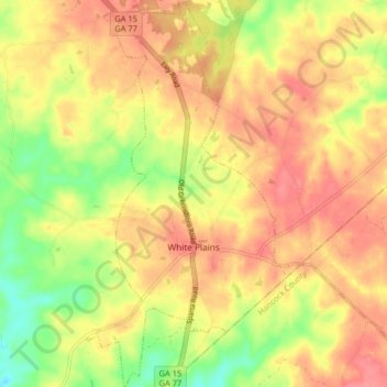
Name: White Plains topographic map, elevation, terrain.
Location: White Plains, Greene County, Georgia, United States (33.44757 -83.05588 33.51526 -83.01285)
Average elevation: 193 m
Minimum elevation: 150 m
Maximum elevation: 221 m
Other topographic maps
Click on a map to view its topography, its elevation and its terrain.
Lake Oconee
United States > Georgia > Greene County > Lake Oconee
Lake Oconee, Greene County, Georgia, United States
Average elevation: 165 m
Greensboro
United States > Georgia > Greene County
Greensboro, Greene County, Georgia, United States
Average elevation: 176 m