
Thank you for supporting this site ❤️
Make a donation
Make a donation
Rosebud topographic map
Click on the map to display elevation.
Thank you for supporting this site ❤️
Make a donation
Make a donation
About this map
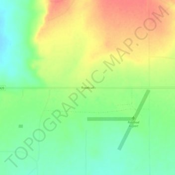
Name: Rosebud topographic map, elevation, terrain.
Location: Rosebud, Harding County, New Mexico, United States (35.82115 -103.46551 35.86115 -103.42551)
Average elevation: 1,468 m
Minimum elevation: 1,441 m
Maximum elevation: 1,498 m
Thank you for supporting this site ❤️
Make a donation
Make a donation
Other topographic maps
Click on a map to view its topography, its elevation and its terrain.