
Bedizzole topographic map
Click on the map to display elevation.
Bedizzole
The municipality of Bedizzole extends for 26.4 km², at an average altitude of 171 m s.l.m. and is about 17 kilometers east from the chief town of the province it belongs to (Brescia) and 8 kilometers from Lake Garda.
About this map
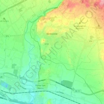
Name: Bedizzole topographic map, elevation, terrain.
Location: Bedizzole, Brescia, Lombardy, 25081, Italy (45.47078 10.36988 45.52708 10.46409)
Average elevation: 163 m
Minimum elevation: 121 m
Maximum elevation: 232 m
Other topographic maps
Click on a map to view its topography, its elevation and its terrain.