
登步岛 topographic map
Interactive map
Click on the map to display elevation.
About this map
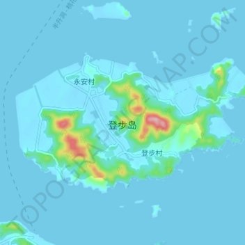
Name: 登步岛 topographic map, elevation, terrain.
Location: 登步岛, 普陀区, 舟山市, 浙江省, 中国 (29.85282 122.27902 29.88555 122.34440)
Average elevation: 11 m
Minimum elevation: -3 m
Maximum elevation: 171 m
Other topographic maps
Click on a map to view its topography, its elevation and its terrain.