
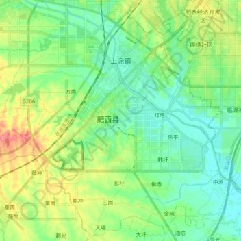
上派镇 topographic map
Interactive map
Click on the map to display elevation.
About this map
Name: 上派镇 topographic map, elevation, terrain.
Location: 上派镇, 肥西县, 合肥市, 安徽省, 231200, 中国 (31.64196 117.07898 31.77386 117.23079)
Average elevation: 25 m
Minimum elevation: 5 m
Maximum elevation: 66 m
Other topographic maps
Click on a map to view its topography, its elevation and its terrain.