
定远乡 topographic map
Interactive map
Click on the map to display elevation.
About this map
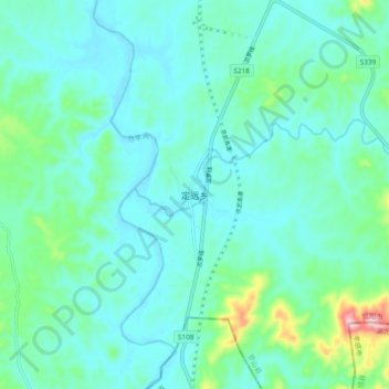
Name: 定远乡 topographic map, elevation, terrain.
Location: 定远乡, 罗山县, 信阳市, 河南省, 中国 (31.75626 114.46670 31.83626 114.54670)
Average elevation: 105 m
Minimum elevation: 63 m
Maximum elevation: 307 m
Other topographic maps
Click on a map to view its topography, its elevation and its terrain.