
广河县 topographic map
Interactive map
Click on the map to display elevation.
About this map
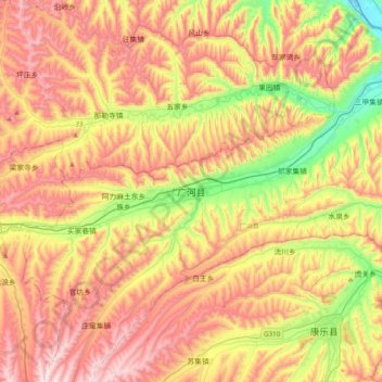
Name: 广河县 topographic map, elevation, terrain.
Location: 广河县, 临夏回族自治州, 甘肃省, 中国 (35.32818 103.40930 35.64818 103.72930)
Average elevation: 2,173 m
Minimum elevation: 1,789 m
Maximum elevation: 2,550 m
Other topographic maps
Click on a map to view its topography, its elevation and its terrain.