
Arta topographic map
Interactive map
Click on the map to display elevation.
About this map
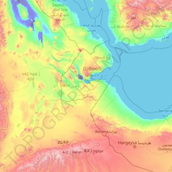
Name: Arta topographic map, elevation, terrain.
Location: Arta, Djibouti (8.78617 39.97428 13.98617 45.17428)
Average elevation: 633 m
Minimum elevation: -154 m
Maximum elevation: 3,267 m
Other topographic maps
Click on a map to view its topography, its elevation and its terrain.