
Tadjourah topographic map
Interactive map
Click on the map to display elevation.
About this map
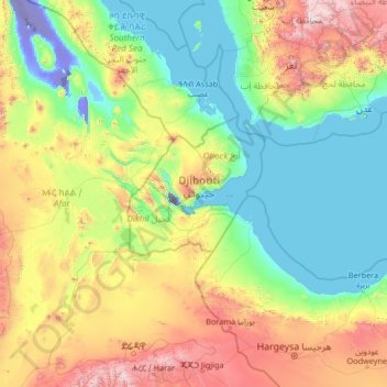
Name: Tadjourah topographic map, elevation, terrain.
Location: Tadjourah, Djibouti (9.13316 40.08159 14.33316 45.28159)
Average elevation: 571 m
Minimum elevation: -154 m
Maximum elevation: 3,267 m