
北大镇 topographic map
Interactive map
Click on the map to display elevation.
About this map
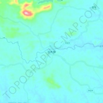
Name: 北大镇 topographic map, elevation, terrain.
Location: 北大镇, 万宁市, 海南省, 中国 (18.88416 110.29079 18.96416 110.37079)
Average elevation: 46 m
Minimum elevation: 15 m
Maximum elevation: 309 m
Other topographic maps
Click on a map to view its topography, its elevation and its terrain.