Geolocate

乌龟山 topographic map

Interactive map

Click on the map to display elevation.

About this map

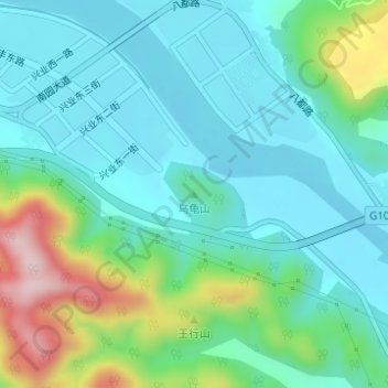
Name: 乌龟山 topographic map, elevation, terrain.

Location: 乌龟山, 天台县, 台州市, 浙江省, 中国 (29.11323 121.04991 29.11333 121.05001)

Average elevation: 110 m

Minimum elevation: 38 m

Maximum elevation: 336 m

Other topographic maps

Click on a map to view its topography, its elevation and its terrain.

楼下山

中国 > 浙江省 > 天台县

楼下山, 天台县, 台州市, 花前产业园区, 浙江省, 317200, 中国

Average elevation: 79 m

官塘市村

中国 > 浙江省 > 天台县

官塘市村, 天台县, 台州市, 花前产业园区, 浙江省, 317200, 中国

Average elevation: 76 m

殿前

中国 > 浙江省 > 天台县

殿前, 天台县, 台州市, 浙江省, 中国

Average elevation: 289 m

上毛蒋

中国 > 浙江省 > 天台县

上毛蒋, 天台县, 台州市, 花前产业园区, 浙江省, 317200, 中国

Average elevation: 69 m

城岭

中国 > 浙江省 > 天台县

城岭, 天台县, 台州市, 浙江省, 中国

Average elevation: 189 m