
Comté de Strathcona topographic map
Interactive map
Click on the map to display elevation.
About this map
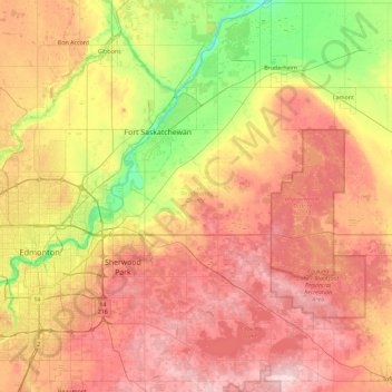
Name: Comté de Strathcona topographic map, elevation, terrain.
Location: Comté de Strathcona, Alberta, Canada (53.35124 -113.40161 53.89390 -112.84047)
Average elevation: 691 m
Minimum elevation: 588 m
Maximum elevation: 798 m
Other topographic maps
Click on a map to view its topography, its elevation and its terrain.
Sherwood Park
Canada > Alberta > Comté de Strathcona
Sherwood Park, Comté de Strathcona, Alberta, Canada
Average elevation: 691 m