
Make a donation
Fort Myers topographic map
Click on the map to display elevation.
Make a donation
Fort Myers
Fort Myers, located in Lee County, Florida, features a predominantly flat topography characterized by low elevations, averaging around 10 to 16 feet (approximately 3 to 5 meters) above sea level. The area is primarily composed of coastal plains, which contribute to its lush, subtropical vegetation and proximity to water bodies such as the Caloosahatchee River and the Gulf of Mexico. The terrain is interspersed with wetlands, providing vital habitats for local wildlife. This flat landscape, combined with the region's sandy soils, supports a rich ecosystem that is both biodiverse and attractive for agricultural activities.
Make a donation
About this map
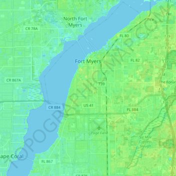
Name: Fort Myers topographic map, elevation, terrain.
Location: Fort Myers, Lee County, Florida, United States (26.54764 -81.91261 26.68918 -81.75114)
Average elevation: 5 m
Minimum elevation: -1 m
Maximum elevation: 13 m
Make a donation
Other topographic maps
Click on a map to view its topography, its elevation and its terrain.
Shangri-La Mobile Home Park
United States > Florida > Lee County > Saint James City
Average elevation: 1 m
Make a donation
Make a donation
Make a donation
Make a donation
Make a donation
Habitat for Humanity Housing
United States > Florida > Lee County > North Fort Myers
Average elevation: 3 m
Make a donation
Make a donation
Make a donation
Make a donation
Make a donation
Make a donation
Make a donation
Bonita National Golf & Country Club
United States > Florida > Lee County > Bonita Springs
Average elevation: 5 m
Make a donation
Make a donation
Make a donation
Make a donation
Make a donation
Sunset North Condominiums
United States > Florida > Lee County > North Fort Myers
Average elevation: 2 m
Saint James Mobile Home Park
United States > Florida > Lee County > Saint James City
Average elevation: 1 m
Make a donation
Rivers Edge Mobile Home Park
United States > Florida > Lee County > North Fort Myers
Average elevation: 2 m
Make a donation
Habitat for Humanity Housing
United States > Florida > Lee County > North Fort Myers
Average elevation: 3 m
Make a donation
Swan Lake Travel Trailer Park
United States > Florida > Lee County > North Fort Myers
Average elevation: 6 m
Make a donation
Make a donation
Caloosa Mobile Home Village
United States > Florida > Lee County > North Fort Myers
Average elevation: 2 m
Make a donation
Make a donation
Council
United States > Florida > Lee County > Bonita Springs > Pelican Landing
Average elevation: 6 m
Make a donation