
Chatyr-Kul topographic map
Interactive map
Click on the map to display elevation.
About this map
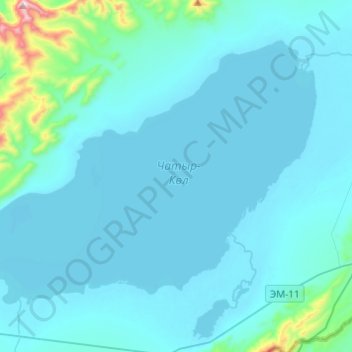
Name: Chatyr-Kul topographic map, elevation, terrain.
Location: Chatyr-Kul, Naryn Region, Kyrgyzstan (40.57082 75.15825 40.70700 75.40225)
Average elevation: 3,592 m
Minimum elevation: 3,526 m
Maximum elevation: 4,462 m
Other topographic maps
Click on a map to view its topography, its elevation and its terrain.
Kochkor River
Kochkor River, Naryn Region, Kyrgyzstan
Average elevation: 1,888 m
Sarychat glacier
Sarychat glacier, Naryn Region, Kyrgyzstan
Average elevation: 4,217 m