
丹霞 topographic map
Interactive map
Click on the map to display elevation.
About this map
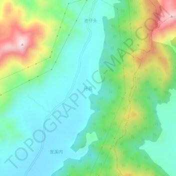
Name: 丹霞 topographic map, elevation, terrain.
Location: 丹霞, 南安市, 泉州市, 福建省, 中国 (25.13928 118.54544 25.17928 118.58544)
Average elevation: 200 m
Minimum elevation: 43 m
Maximum elevation: 573 m
Other topographic maps
Click on a map to view its topography, its elevation and its terrain.