
Laguna Quilotoa topographic map
Interactive map
Click on the map to display elevation.
About this map
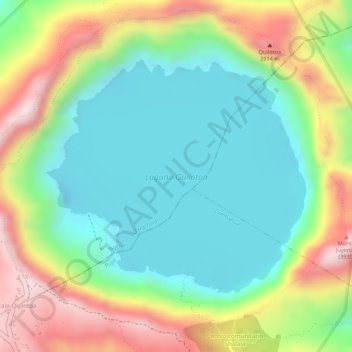
Name: Laguna Quilotoa topographic map, elevation, terrain.
Location: Laguna Quilotoa, Chugchillan, Sigchos, Cotopaxi, Ecuador (-0.86816 -78.91423 -0.85025 -78.89429)
Average elevation: 3,636 m
Minimum elevation: 3,484 m
Maximum elevation: 3,876 m
Other topographic maps
Click on a map to view its topography, its elevation and its terrain.
Quilotoa
Ecuador > Cotopaxi > Sigchos > Chugchillan
Quilotoa, Chugchillan, Sigchos, Cotopaxi, 050456, Ecuador
Average elevation: 3,553 m
Chugchillan
Ecuador > Cotopaxi > Sigchos > Chugchillan
Chugchillan, Sigchos, Cotopaxi, 00000, Ecuador
Average elevation: 3,158 m