
Chugchillan topographic map
Interactive map
Click on the map to display elevation.
About this map
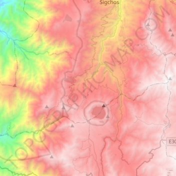
Name: Chugchillan topographic map, elevation, terrain.
Location: Chugchillan, Sigchos, Cotopaxi, 00000, Ecuador (-0.89499 -79.11735 -0.75441 -78.87170)
Average elevation: 3,158 m
Minimum elevation: 1,188 m
Maximum elevation: 4,280 m
Other topographic maps
Click on a map to view its topography, its elevation and its terrain.
Quilotoa
Ecuador > Cotopaxi > Sigchos > Chugchillan
Quilotoa, Chugchillan, Sigchos, Cotopaxi, 050456, Ecuador
Average elevation: 3,553 m
Laguna Quilotoa
Ecuador > Cotopaxi > Sigchos > Chugchillan
Laguna Quilotoa, Chugchillan, Sigchos, Cotopaxi, Ecuador
Average elevation: 3,636 m