
Papiermühle topographic map
Interactive map
Click on the map to display elevation.
About this map
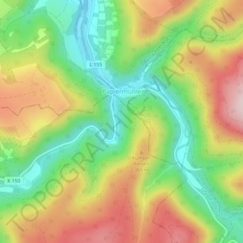
Name: Papiermühle topographic map, elevation, terrain.
Average elevation: 296 m
Minimum elevation: 140 m
Maximum elevation: 485 m
Other topographic maps
Click on a map to view its topography, its elevation and its terrain.
Neumagen-Dhron
Deutschland > Rheinland-Pfalz > Landkreis Bernkastel-Wittlich > Neumagen-Dhron
Neumagen-Dhron, Bernkastel-Kues, Landkreis Bernkastel-Wittlich, Rheinland-Pfalz, 54347, Deutschland
Average elevation: 218 m