
麦园村 topographic map
Interactive map
Click on the map to display elevation.
About this map
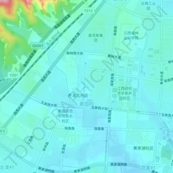
Name: 麦园村 topographic map, elevation, terrain.
Location: 麦园村, 蛟桥街道, 南昌经开区, 新建区, 南昌市, 江西省, 中国 (28.71451 115.78555 28.74937 115.81227)
Average elevation: 44 m
Minimum elevation: 20 m
Maximum elevation: 204 m
Other topographic maps
Click on a map to view its topography, its elevation and its terrain.