
Thank you for supporting this site ❤️
Make a donation
Make a donation
Stal topographic map
Click on the map to display elevation.
Thank you for supporting this site ❤️
Make a donation
Make a donation
About this map
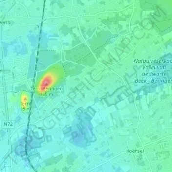
Name: Stal topographic map, elevation, terrain.
Location: Stal, Koersel, Beringen, Hasselt, Limburg, 3582, België (51.05250 5.23057 51.09250 5.27057)
Average elevation: 40 m
Minimum elevation: 25 m
Maximum elevation: 126 m
Thank you for supporting this site ❤️
Make a donation
Make a donation
Other topographic maps
Click on a map to view its topography, its elevation and its terrain.
Thank you for supporting this site ❤️
Make a donation
Make a donation