
Bouandas topographic map
Interactive map
Click on the map to display elevation.
About this map
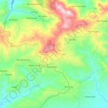
Name: Bouandas topographic map, elevation, terrain.
Location: Bouandas, Daïra Bouandas, Sétif, Algérie (36.47403 5.04938 36.53515 5.16027)
Average elevation: 997 m
Minimum elevation: 607 m
Maximum elevation: 1,682 m
Other topographic maps
Click on a map to view its topography, its elevation and its terrain.
Bousselam
Algérie > Sétif > Daïra Bouandas
Bousselam, Daïra Bouandas, Sétif, 19124, Algérie
Average elevation: 816 m
Aït Nawal M'zada
Algérie > Sétif > Daïra Bouandas
Aït Nawal M'zada, Daïra Bouandas, Sétif, Algérie
Average elevation: 1,022 m