
龙门浩街道 topographic map
Interactive map
Click on the map to display elevation.
About this map
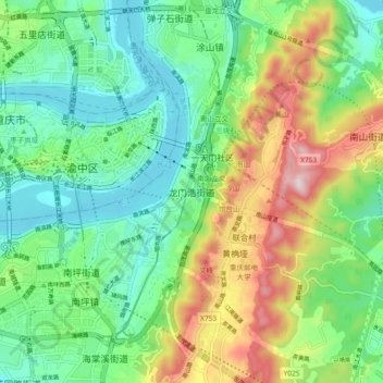
Name: 龙门浩街道 topographic map, elevation, terrain.
Location: 龙门浩街道, 南岸区, 重庆市主城都市区, 重庆市, 400066, 中国 (29.51043 106.55161 29.59043 106.63161)
Average elevation: 315 m
Minimum elevation: 150 m
Maximum elevation: 651 m
Other topographic maps
Click on a map to view its topography, its elevation and its terrain.