
Simanjiro topographic map
Interactive map
Click on the map to display elevation.
About this map
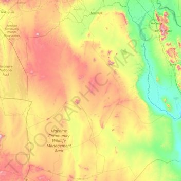
Name: Simanjiro topographic map, elevation, terrain.
Location: Simanjiro, Manyara, Northern Zone, Tanzania (-5.22008 36.29974 -3.43212 38.03910)
Average elevation: 1,103 m
Minimum elevation: 598 m
Maximum elevation: 2,107 m
Other topographic maps
Click on a map to view its topography, its elevation and its terrain.
Lake Ambussel
Lake Ambussel, Simanjiro, Manyara, Northern Zone, Tanzania
Average elevation: 945 m