
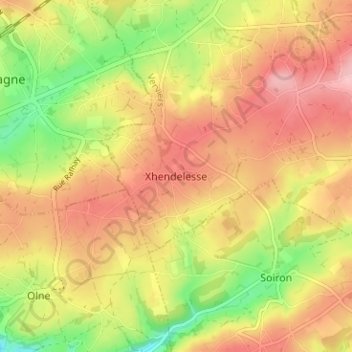
Xhendelesse topographic map
Interactive map
Click on the map to display elevation.
About this map
Name: Xhendelesse topographic map, elevation, terrain.
Location: Xhendelesse, Herve, Verviers, Luik, Wallonië, 4650, België (50.58370 5.75265 50.62370 5.79265)
Average elevation: 242 m
Minimum elevation: 161 m
Maximum elevation: 304 m
Xhendelesse ligt in het Land van Herve op een hoogte van ongeveer 270 meter. Het dorp ligt te midden van landbouwgebied.
Other topographic maps
Click on a map to view its topography, its elevation and its terrain.