

Thank you for supporting this site ❤️
Make a donation
Make a donation
Tigray topographic maps
Click on a map to view its topography, its elevation and its terrain.


Thank you for supporting this site ❤️
Make a donation
Make a donation

Humera
Humera (Tigrinya: ሑመራ; Amharic: ሁመራ) is a town in the Kafta Humera woreda in the Tigray Region of Ethiopia. Located in the Western Zone the town has an elevation of 585 metres (1,919 ft) above sea level. The Tekezé river borders the town to the north. Humera is a very important regional…
Average elevation: 594 m
Thank you for supporting this site ❤️
Make a donation
Make a donation


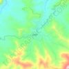

Sheraro
Sheraro (Tigrinya: ሸራሮ) is a town and separate woreda in Tigray, Ethiopia. It is located in the North Western Zone of the Tigray Region, at an elevation of 1246 meters above sea level. It is the administrative center of Tahtay Adiyabo. It is near the border with Eritrea.
Average elevation: 1,041 m
Thank you for supporting this site ❤️
Make a donation
Make a donation