

Cornwall topographic maps
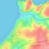
Click on a map to view its topography, its elevation and its terrain.




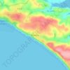
St. John
United Kingdom > England > Cornwall
A few hundred metres north of St John village is an area of high ground called Vanderbands, the site of an Iron Age castle mentioned by John Norden (an English topographer who wrote a series of county histories) in his description of Cornwall published in 1728.
Average elevation: 53 m

































About this place
Camborne • St Just • Falmouth • Penzance • St. Ives • Looe • Mylor Bridge • Saltash • London Apprentice • Callington • Roche • Porthoustock • St. Columb Major • Feock • Marazion • Newquay • Padstow • Launceston • Shop • Crafthole • Doublebois • Torpoint • Carnkie • St Clether • Perranwell • Caradon Town • Hayle • Altarnun • St. Enoder • Sancreed • Higher Crackington • Mount Hawke • Trebetherick • Perranzabuloe • Polperro • Cawsand • North Hill • Towednack • Lanreath • Blackwater • Yeolmbridge • Sithney • Porthallow • Egloskerry • Lanivet • Camelford • Budock Water • Pensilva • Constantine Bay • Trevivian • Job's Water • Lizard • Halwartha • St Dennis • Foxhole • Pool • Tregadillet • North Tamerton • St. Mabyn • Lanhydrock • St Kew • Kea • Tresmeer • St Neot • Kilkhampton • Carnhell Green • Coad's Green • St Issey • Stenalees • Malpas • Helford • Warbstow • Calvadnack • Mylor Churchtown • Ruan Minor • St. Levan • St Martin • Duloe • Penwithick • St. Eval • Davidstow • Mawnan • St. Dominick • Veryan • St. Agnes • Comford • Week St Mary • Newbridge • Porth Navas • Menheniot • Lower Drift • Gweek • Crowan • Rosudgeon • Treknow • Connor Downs • Ludgvan • Wendron • Frogpool • Mabe Burnthouse