
Alameda County topographic map
Interactive map
Click on the map to display elevation.
About this map
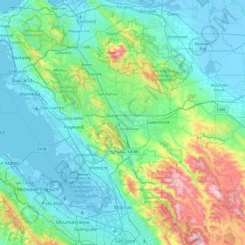
Name: Alameda County topographic map, elevation, terrain.
Location: Alameda County, California, United States (37.45395 -122.37384 37.90669 -121.46909)
Average elevation: 219 m
Minimum elevation: -7 m
Maximum elevation: 1,291 m