
Pavia topographic map
Interactive map
Click on the map to display elevation.
Pavia
From an elevation point of view, the city has various heights. The highest point is located in the area of the Visconti Castle, about 80 m (260 ft) above sea level, and then slowly declines. From an altitude of 80 m (260 ft), you pass to 77 m (253 ft) in about 500 m (550 yd; 1,600 ft). Downstream from Piazza Vittoria, where the cardo and decumanus of the Roman city crossed, the slope becomes more pronounced, up to just under 60 m (200 ft) above sea level near the Ponte Coperto.
About this map
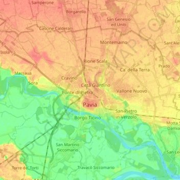
Name: Pavia topographic map, elevation, terrain.
Location: Pavia, Lombardy, 27100, Italy (45.15574 9.09038 45.23331 9.24055)
Average elevation: 74 m
Minimum elevation: 50 m
Maximum elevation: 93 m
Other topographic maps
Click on a map to view its topography, its elevation and its terrain.