
Droeshout topographic map
Interactive map
Click on the map to display elevation.
About this map
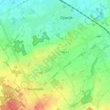
Name: Droeshout topographic map, elevation, terrain.
Average elevation: 33 m
Minimum elevation: 11 m
Maximum elevation: 70 m
Other topographic maps
Click on a map to view its topography, its elevation and its terrain.
Mazenzele
België > Vlaams-Brabant > Halle-Vilvoorde > Opwijk
Mazenzele, Opwijk, Halle-Vilvoorde, Vlaams-Brabant, België
Average elevation: 50 m