
Mazenzele topographic map
Interactive map
Click on the map to display elevation.
About this map
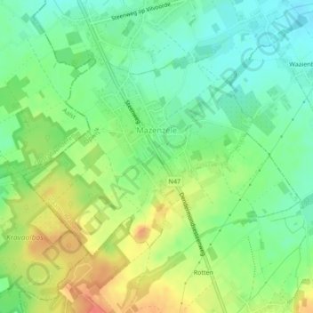
Name: Mazenzele topographic map, elevation, terrain.
Location: Mazenzele, Opwijk, Halle-Vilvoorde, Vlaams-Brabant, België (50.93202 4.15345 50.94919 4.18496)
Average elevation: 50 m
Minimum elevation: 28 m
Maximum elevation: 81 m
Other topographic maps
Click on a map to view its topography, its elevation and its terrain.
Droeshout
België > Vlaams-Brabant > Halle-Vilvoorde > Opwijk
Droeshout, Opwijk, Halle-Vilvoorde, Vlaams-Brabant, Vlaanderen, 1745, België
Average elevation: 33 m