
Barisal Division topographic map
Interactive map
Click on the map to display elevation.
About this map
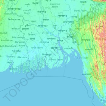
Name: Barisal Division topographic map, elevation, terrain.
Location: Barisal Division, Bangladesh (19.92606 87.69882 25.12606 92.89882)
Average elevation: 53 m
Minimum elevation: -3 m
Maximum elevation: 1,999 m
Other topographic maps
Click on a map to view its topography, its elevation and its terrain.