
New Brunswick topographic map
Interactive map
Click on the map to display elevation.
About this map
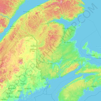
Name: New Brunswick topographic map, elevation, terrain.
Location: New Brunswick, Canada (43.94028 -69.31018 49.06028 -64.19018)
Average elevation: 165 m
Minimum elevation: -3 m
Maximum elevation: 1,412 m
Other topographic maps
Click on a map to view its topography, its elevation and its terrain.