
Apurímac topographic map
Interactive map
Click on the map to display elevation.
About this map
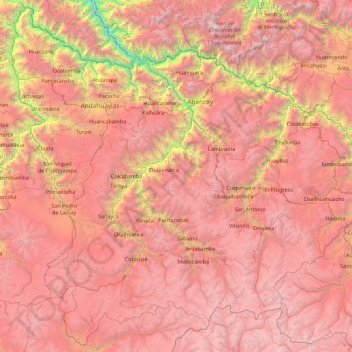
Name: Apurímac topographic map, elevation, terrain.
Location: Apurímac, Peru (-14.84273 -73.84745 -13.17071 -72.05120)
Average elevation: 3,884 m
Minimum elevation: 963 m
Maximum elevation: 6,134 m
Other topographic maps
Click on a map to view its topography, its elevation and its terrain.
La Rinconada
Peru > Puno > La Rinconada
High in the Andes, La Rinconada has an alpine tundra climate (ET, according to the Köppen climate classification), with no month having mean temperatures even close to the 10 °C (50 °F) threshold that would permit tree growth and a subtropical highland classification for the city. Far above the tree line,…
Average elevation: 4,646 m