
Loch Cluanie topographic map
Click on the map to display elevation.
About this map
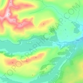
Name: Loch Cluanie topographic map, elevation, terrain.
Average elevation: 413 m
Minimum elevation: 132 m
Maximum elevation: 1,093 m
Other topographic maps
Click on a map to view its topography, its elevation and its terrain.
Cairn Gorm
Cairn Gorm (Cairngorm) (Scottish Gaelic: An Càrn Gorm, meaning The Blue Hill) is a mountain in the Scottish Highlands overlooking Strathspey and the town of Aviemore. Cairn Gorm has a summit elevation of 1,245 metres (4,084 feet) AMSL and is the seventh-highest mountain in both the United Kingdom and the…
Average elevation: 989 m
Kirkcaldy
United Kingdom > Scotland > Fife
Towards the end of the 16th century, a detailed assessment on the size of the townscape was carried out.[17] The first estimate of the parish population in 1639 was between 3,000 and 3,200 and around 3,400 by 1691. At the beginning of the 18th century, the population declined.[17] A census by Webster's…
Average elevation: 50 m