
Île Rodrigues topographic map
Interactive map
Click on the map to display elevation.
About this map
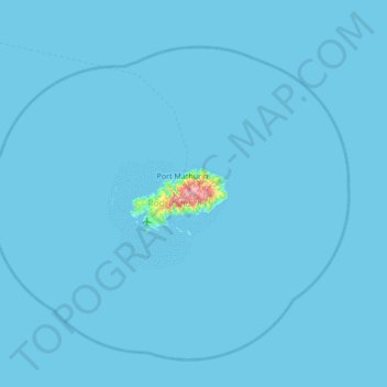
Name: Île Rodrigues topographic map, elevation, terrain.
Location: Île Rodrigues, Rodrigues, Mauritius (-20.02920 63.12260 -19.38920 63.76260)
Average elevation: 3 m
Minimum elevation: 0 m
Maximum elevation: 378 m
Other topographic maps
Click on a map to view its topography, its elevation and its terrain.