
Rodrigues topographic map
Interactive map
Click on the map to display elevation.
About this map
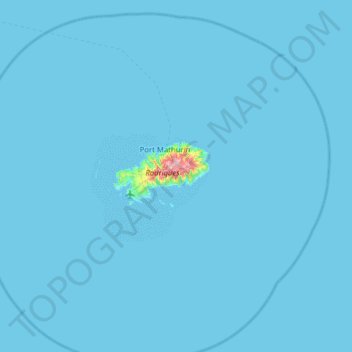
Name: Rodrigues topographic map, elevation, terrain.
Location: Rodrigues, Mauritius (-19.98500 63.08619 -19.46700 63.71513)
Average elevation: 3 m
Minimum elevation: 0 m
Maximum elevation: 378 m
Other topographic maps
Click on a map to view its topography, its elevation and its terrain.