
Manali topographic map
Interactive map
Click on the map to display elevation.
About this map
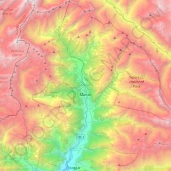
Name: Manali topographic map, elevation, terrain.
Location: Manali, Kullu, Himachal Pradesh, India (32.10806 77.02620 32.41518 77.39285)
Average elevation: 3,745 m
Minimum elevation: 1,459 m
Maximum elevation: 5,911 m
Other topographic maps
Click on a map to view its topography, its elevation and its terrain.