
Karmoey topographic map
Interactive map
Click on the map to display elevation.
About this map
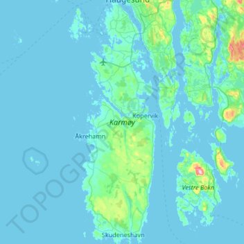
Name: Karmoey topographic map, elevation, terrain.
Location: Karmoey, Karmøy, Rogaland, Norway (59.13959 5.16675 59.41260 5.33032)
Average elevation: 16 m
Minimum elevation: -2 m
Maximum elevation: 289 m
Other topographic maps
Click on a map to view its topography, its elevation and its terrain.
Halti
Halti (Finnish: Halti, rarely Haltiatunturi, Northern Sami: Háldičohkka, Swedish: Halde fjäll) is a fell at the border between Norway and Finland. The peak (elevation 1,365 m (4,478 ft)) of the fell, called Ráisduattarháldi, is in Norway, on the border between the municipalities of Nordreisa and…
Average elevation: 1,192 m