
涔天河水库 topographic map
Interactive map
Click on the map to display elevation.
About this map
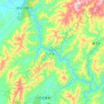
Name: 涔天河水库 topographic map, elevation, terrain.
Location: 涔天河水库, 涔天河镇, 江华瑶族自治县, 永州市, 湖南省, 中国 (24.94559 111.66275 25.15406 111.91558)
Average elevation: 580 m
Minimum elevation: 216 m
Maximum elevation: 1,494 m
Other topographic maps
Click on a map to view its topography, its elevation and its terrain.