
Thank you for supporting this site ❤️
Make a donation
Make a donation
Addah topographic map
Click on the map to display elevation.
Thank you for supporting this site ❤️
Make a donation
Make a donation
About this map
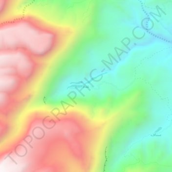
Name: Addah topographic map, elevation, terrain.
Location: Addah, Ach-Charqiya du Sud, Oman (22.57990 59.24923 22.61990 59.28923)
Average elevation: 925 m
Minimum elevation: 420 m
Maximum elevation: 1,570 m
Thank you for supporting this site ❤️
Make a donation
Make a donation
Other topographic maps
Click on a map to view its topography, its elevation and its terrain.