
Thank you for supporting this site ❤️
Make a donation
Make a donation
Purvis topographic map
Click on the map to display elevation.
Thank you for supporting this site ❤️
Make a donation
Make a donation
About this map
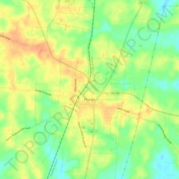
Name: Purvis topographic map, elevation, terrain.
Location: Purvis, Lamar County, Mississippi, United States (31.12338 -89.42666 31.17106 -89.36646)
Average elevation: 105 m
Minimum elevation: 83 m
Maximum elevation: 124 m
Thank you for supporting this site ❤️
Make a donation
Make a donation
Other topographic maps
Click on a map to view its topography, its elevation and its terrain.