
Batzlow topographic map
Interactive map
Click on the map to display elevation.
About this map
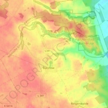
Name: Batzlow topographic map, elevation, terrain.
Average elevation: 52 m
Minimum elevation: 11 m
Maximum elevation: 75 m
Other topographic maps
Click on a map to view its topography, its elevation and its terrain.
Ringenwalde
Deutschland > Brandenburg > Märkisch-Oderland > Märkische Höhe
Ringenwalde, Märkische Höhe, Märkische Schweiz, Märkisch-Oderland, Brandenburg, Deutschland
Average elevation: 42 m