
Nioro du Sahel topographic map
Interactive map
Click on the map to display elevation.
About this map
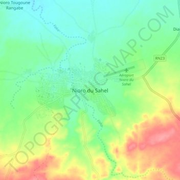
Name: Nioro du Sahel topographic map, elevation, terrain.
Location: Nioro du Sahel, Cercle de Nioro, Kayes, Mali (15.19045 -9.62991 15.27045 -9.54991)
Average elevation: 246 m
Minimum elevation: 216 m
Maximum elevation: 297 m