
Thank you for supporting this site ❤️
Make a donation
Make a donation
Demre topographic map
Click on the map to display elevation.
Thank you for supporting this site ❤️
Make a donation
Make a donation
About this map
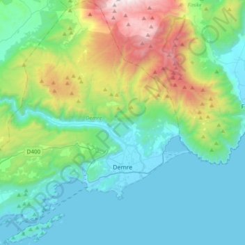
Name: Demre topographic map, elevation, terrain.
Location: Demre, Antalya, Mediterranean Region, Turkey (36.16681 29.78889 36.41041 30.07169)
Average elevation: 495 m
Minimum elevation: -4 m
Maximum elevation: 2,246 m
Thank you for supporting this site ❤️
Make a donation
Make a donation
Other topographic maps
Click on a map to view its topography, its elevation and its terrain.