
Thank you for supporting this site ❤️
Make a donation
Make a donation
Mtskheta-Mtianeti topographic map
Click on the map to display elevation.
Thank you for supporting this site ❤️
Make a donation
Make a donation
About this map
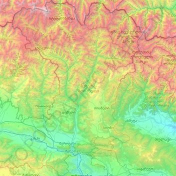
Name: Mtskheta-Mtianeti topographic map, elevation, terrain.
Location: Mtskheta-Mtianeti, Georgia (41.69141 44.22561 42.76639 45.31091)
Average elevation: 1,685 m
Minimum elevation: 348 m
Maximum elevation: 4,984 m
Thank you for supporting this site ❤️
Make a donation
Make a donation
Other topographic maps
Click on a map to view its topography, its elevation and its terrain.