
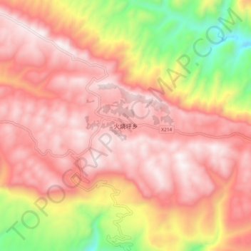
火烧坪乡 topographic map
Interactive map
Click on the map to display elevation.
About this map
Name: 火烧坪乡 topographic map, elevation, terrain.
Location: 火烧坪乡, 宜昌市, 湖北省, 中国 (30.46614 110.68607 30.54614 110.76607)
Average elevation: 1,546 m
Minimum elevation: 791 m
Maximum elevation: 1,969 m
Other topographic maps
Click on a map to view its topography, its elevation and its terrain.