
新厝镇 topographic map
Interactive map
Click on the map to display elevation.
About this map
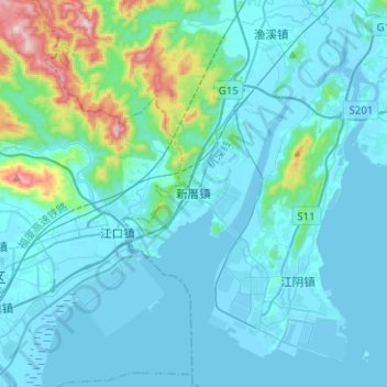
Name: 新厝镇 topographic map, elevation, terrain.
Location: 新厝镇, 福清市, 福州市, 福建省, 中国 (25.39663 119.15076 25.62288 119.29401)
Average elevation: 80 m
Minimum elevation: -4 m
Maximum elevation: 705 m
Other topographic maps
Click on a map to view its topography, its elevation and its terrain.