
Thank you for supporting this site ❤️
Make a donation
Make a donation
Bagnolo Piemonte topographic map
Click on the map to display elevation.
Thank you for supporting this site ❤️
Make a donation
Make a donation
About this map
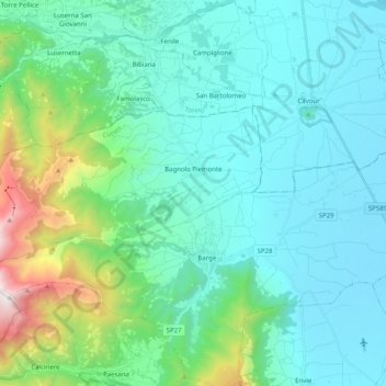
Name: Bagnolo Piemonte topographic map, elevation, terrain.
Location: Bagnolo Piemonte, Cuneo, Piedmont, 12031, Italy (44.71978 7.14943 44.78313 7.34961)
Average elevation: 573 m
Minimum elevation: 265 m
Maximum elevation: 2,029 m
Thank you for supporting this site ❤️
Make a donation
Make a donation
Other topographic maps
Click on a map to view its topography, its elevation and its terrain.
Thank you for supporting this site ❤️
Make a donation
Make a donation
Mont Vallonnet Nord / Cima las Blancias
Italy > Piedmont > Cuneo > Pietraporzio
Average elevation: 2,522 m