
Thank you for supporting this site ❤️
Make a donation
Make a donation
Saretto topographic map
Click on the map to display elevation.
Thank you for supporting this site ❤️
Make a donation
Make a donation
About this map
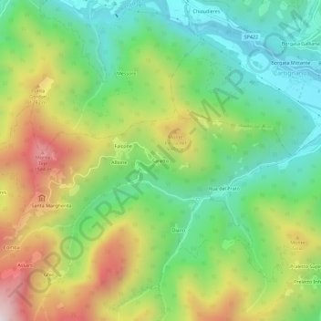
Name: Saretto topographic map, elevation, terrain.
Location: Saretto, Dronero, Cuneo, Piedmont, 12029, Italy (44.44666 7.24513 44.48666 7.28513)
Average elevation: 1,033 m
Minimum elevation: 657 m
Maximum elevation: 1,633 m
Thank you for supporting this site ❤️
Make a donation
Make a donation